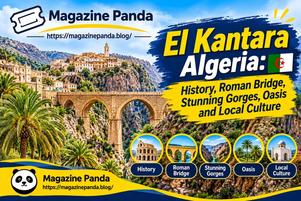

El Kantara is one of Algeria’s most distinctive historic destinations. Located in Biskra Province, this small town is known for its dramatic rocky gorge, ancient stone bridge, traditional settlements, and green palm groves. Its landscape marks a remarkable transition between the Aurès Mountains and the northern edge of the Sahara.
Often described as the gateway to the Sahara, El Kantara offers much more than beautiful scenery. Its history reflects Roman travel routes, traditional oasis life, historic communities, and generations of agricultural activity. The town’s architecture and natural surroundings also reveal how people adapted their lives to a dry climate and limited water resources.
Today, El Kantara remains an interesting destination for travellers, photographers, history enthusiasts and anyone interested in Algeria’s cultural heritage. Its combination of mountain scenery, old villages and palm-filled landscapes makes it a place worth exploring.
Where Is El Kantara?
El Kantara is a municipality in Biskra Province in northeastern Algeria. It lies in the transition zone between the mountainous Aurès region and the landscapes associated with the Sahara. This geographical position has shaped its history, climate, settlement patterns, and economic activities.
According to the official Biskra provincial investment profile, the municipality covers approximately 239.10 square kilometres and had a recorded population of 17,059 in December 2025. It is located approximately 53 kilometres from the provincial administrative centre of Biskra.
The municipality is accessible through National Road 03 (RN3), an important road connection in this part of Algeria. Its location has historically made the area a natural passage between northern settlements and communities further south.
The surrounding landscape includes rocky mountain formations, valleys, agricultural land, and palm groves. These contrasting features make El Kantara geographically interesting, especially for visitors who want to understand how Algeria’s northern and southern environments meet.
Why Is It Called El Kantara?
The name El Kantara comes from the Arabic word associated with a bridge or arched crossing. It reflects the area’s historical connection with a stone bridge that once helped travellers cross the watercourse running through the gorge.
The bridge was particularly important because the narrow passage provided a natural route through the surrounding mountains. According to research conducted at Constantine 3 University, a Roman road crossed the gorge and used a stone bridge to connect the two sides of the river.
This historical connection explains why the name became associated with both the gorge and the oasis settlement. It also shows how geographical features influenced the development of local communities.
The name is more than a geographical label. It represents the importance of movement, trade, and communication in the region’s history.
A History Shaped by Ancient Routes
El Kantara has a long history connected with movement across northeastern Algeria. Its position between the Aurès Mountains and the Sahara made it useful for people travelling between northern and southern settlements.
Academic research describes the area as an important Roman-era passage. The Roman presence is associated with the ancient name Calceus Herculis, although historical interpretations of the name should be treated with care. The stone bridge and archaeological remains are among the features connected with this period.
The route helped people move goods and travel through a difficult mountainous landscape. Ancient transport links were especially valuable in areas where steep rock formations could otherwise make journeys challenging.
The region continued to develop after the Roman period. Research on El Kantara’s traditional settlements discusses early Islamic settlement and the later arrival of Arab and Berber communities. These historical movements helped shape the social and architectural identity of the oasis.
During the French colonial period, the area’s transport infrastructure changed. A newer road and railway were developed alongside the older routes, creating additional connections through the mountains.
These different historical periods have left their mark on the town. El Kantara’s heritage is therefore not limited to one monument or civilisation. It reflects centuries of movement, settlement and adaptation.
The Famous El Kantara Gorge
The gorge is the natural landmark most closely associated with El Kantara. Its rocky walls create a dramatic passage through the mountains, with the river, road and railway following the narrow landscape.
The gorge is locally associated with the expression Foum Essahra, meaning the mouth of the Sahara. The name describes its geographical role as a passage from the northern highlands towards the drier landscapes to the south.
The surrounding rock formations create a striking contrast with the greenery found near the watercourse. Palm trees and cultivated land appear beside the rugged mountain environment, giving the area a distinctive appearance.
For photographers, the gorge offers interesting views throughout the day. Changes in sunlight create different colours and shadows across the rocky walls, while the palm groves provide a softer contrast to the surrounding landscape.
The gorge is also important for understanding the area’s settlement history. Its narrow passage helped concentrate travel through a relatively limited corridor, making El Kantara a significant connection point for generations of visitors and residents.
The Historic Roman Bridge
The historic stone bridge is one of El Kantara’s most important archaeological features. Academic research identifies it as part of an ancient Roman route that crossed the gorge and connected the two banks of the river.
The bridge demonstrates how earlier communities responded to the challenges of the natural environment. Rather than avoiding the mountainous passage, travellers used engineering and construction to create a practical crossing.
The bridge is particularly interesting because it links the town’s name with its historical function. It also provides a visible reminder of the area’s role in ancient transport networks.
The old structure has been restored as an archaeological feature, according to research published by Constantine 3 University. Modern road infrastructure follows a different route and does not depend on the historic crossing.
Visitors interested in Roman history may find this site especially valuable. However, the bridge should be understood as part of a wider heritage landscape that includes the gorge, old settlements and surrounding archaeological remains.
Traditional Villages and Architecture
El Kantara’s traditional architecture is another important part of its identity. Academic research identifies three historic settlement areas: Dachra, Gregueur and Bor Abbas. They are also described through the traditional names of the red, white, and black villages.
Dachra El Hamra, often translated as the Red Village, is particularly notable for its traditional urban character. It developed close to the gorge and the palm groves, where access to water and important travel routes supported settlement.
The older villages feature narrow streets, winding passages, small squares and traditional houses. Their layout reflects the needs of communities living in a hot, dry environment where shade, privacy and efficient use of space were important.
Research published in the Journal of Building Materials and Structures describes Dachra El Hamra as a traditional settlement with a compact urban layout and architectural characteristics associated with historic North African and Saharan towns.
Covered passages, courtyards, and narrow streets helped create shaded spaces. These features were not simply decorative choices. They were practical responses to sunlight, temperature, and everyday social life.
The traditional villages provide a valuable opportunity to understand local architectural knowledge. Their streets and buildings show how communities developed settlements that responded to both environmental conditions and cultural traditions.
The Oasis and Date Palm Groves
The oasis is one of the most attractive features of El Kantara. Green palm trees grow alongside the river, creating a clear contrast with the dry mountains and surrounding rocky terrain.
Water has always been central to the area’s development. The historic local water system included dams and irrigation channels that helped distribute river water to the palm groves and surrounding agricultural land.
An Algerian government cultural reference describes four successive dams on the El Kantara River: Grand Sed, Fougania, Rommail and El Outania. It also records five irrigation channels, known as seguias, serving the oasis and nearby cultivated areas.
These systems demonstrate the importance of organised water management in an arid region. Agriculture in such environments depends on careful use of available water and cooperation among local communities.
Date palms remain an important part of the municipality’s agricultural landscape. The local provincial investment dossier records 27,990 palm trees in its agricultural statistics, alongside production information for Deglet Nour dates.
The palm groves are more than agricultural land. They are part of the town’s visual identity and traditional way of life.
Climate and Natural Environment
El Kantara has an arid climate, according to the official municipal profile. Annual rainfall varies considerably, with the local administrative information reporting a range from less than 40 millimetres to nearly 300 millimetres.
Summer conditions can be particularly hot, while the surrounding mountains create a landscape that differs from the flatter desert areas further south.
A scientific study published in 2018 examined how the urban form of Dachra El Hamra affects outdoor thermal comfort. It considered factors such as air temperature, humidity, wind speed, and solar radiation.
The research highlights an important aspect of traditional architecture: buildings and streets can influence how people experience heat. Narrow streets and shaded spaces can reduce direct exposure to strong sunlight.
The surrounding environment also supports a variety of wild plants. An ethnobotanical survey of the El Kantara area documented 60 wild plant species belonging to 29 botanical families, based on information collected from local participants.
This research provides evidence of the area’s plant diversity and the traditional knowledge associated with local vegetation. It also highlights the importance of documenting local environmental practices.
Agriculture and the Local Economy
Agriculture remains an important part of El Kantara’s local economy. Its palm groves, irrigated land, and surrounding agricultural areas support traditional production activities.
The official provincial investment dossier reports a total agricultural area of approximately 7,309 hectares. Of this, around 1,427 hectares are classified as useful agricultural land, while approximately 701.7 hectares are irrigated.
Date palms are a particularly important agricultural resource. The Deglet Nour variety is included in the municipality’s recorded agricultural production statistics.
Livestock farming also contributes to the local economy. The same government profile records sheep and goat populations, alongside smaller numbers of cattle and other livestock.
Commerce and services provide additional economic activity. The local investment document identifies registered businesses across retail, services, wholesale distribution and other commercial categories.
Artisans also contribute to the town’s economic and cultural life. The provincial profile records 180 registered artisans, two cooperatives and one enterprise in its artisan and cooperative statistics.
These figures offer a useful picture of the local economy, although they should be understood as administrative records rather than a complete measurement of every informal economic activity.
What Can Visitors See in El Kantara?
El Kantara is particularly suitable for visitors interested in natural scenery, traditional architecture and local history.
The gorge is an obvious starting point. Its high rock walls and narrow passage create a memorable landscape, especially when viewed from different points along the surrounding road.
The historic bridge is another important attraction for people interested in ancient engineering. It offers a connection to the Roman-era transport routes that helped shape the area’s importance.
Visitors can also explore the older settlement areas, including Dachra El Hamra. Walking through traditional streets provides a closer look at the architectural patterns and settlement arrangements that developed over generations.
The palm groves offer a different experience. Their greenery creates a peaceful contrast with the rocky surroundings, while the river and irrigation features help explain how the oasis developed.
Photography is another reason to visit. The combination of mountains, palm trees, traditional buildings, and open landscapes provides a variety of subjects.
Visitors should remember that El Kantara is a living municipality, not simply an open-air tourist attraction. Respecting residents, private property, and local customs is important when exploring its historic areas.
How to Reach El Kantara
El Kantara is accessible by road through National Road 03. The official municipal profile identifies this route as an access connection and places the municipality approximately 53 kilometres from Biskra’s administrative centre.
Travellers planning a visit can use Biskra as a practical starting point. Checking current road conditions and available transport before travelling is advisable, particularly during periods of extreme heat.
The town’s location also makes it relevant to people travelling through the Aurès region. Its position between mountainous terrain and the Sahara gives it a distinctive geographical setting.
For visitors coming from outside Algeria, it is sensible to organise transport and accommodation in advance. The municipality’s official investment profile does not list a designated tourism expansion zone, so travellers should not assume that every visitor facility is available locally.
A planned visit can include the gorge, historic bridge, traditional villages and palm groves. Allowing enough time to explore these areas makes the experience more rewarding than simply passing through the town.
Why El Kantara Matters Today
El Kantara is important because it brings together several aspects of Algeria’s natural and cultural heritage. Its geography explains why ancient travellers used the gorge, while its historic settlements show how communities adapted to the environment.
The Roman bridge provides evidence of earlier transport infrastructure. The traditional villages preserve architectural features developed in response to local climate and social needs.
The oasis and irrigation channels also demonstrate the relationship between water management and settlement. In an arid environment, access to water shapes agriculture, economic activity, and communities’ long-term survival.
Modern development creates both opportunities and challenges. Improving transport, services and visitor facilities could support the local economy, but development should also respect the area’s historic structures and natural surroundings.
El Kantara’s heritage is valuable not only to visitors but also to residents whose identity is connected with the landscape. Protecting the gorge, old villages, archaeological remains and agricultural traditions can help preserve this connection for future generations.
Final Thoughts
El Kantara is a remarkable destination in Biskra Province, where mountain scenery, ancient history and traditional oasis life come together. Its famous gorge and historic stone bridge explain the town’s geographical importance, while its old villages and palm groves reveal the cultural traditions that have shaped local life.
The town may be small compared with Algeria’s major cities, but its historical and environmental significance makes it worth discovering. For anyone interested in Roman heritage, traditional architecture, or the landscapes of northeastern Algeria, El Kantara offers a meaningful experience beyond ordinary sightseeing.
Its greatest attraction is the relationship between nature and human history. The gorge created the passage, the bridge made crossing possible, and the oasis gave communities a reason to settle and grow.
Frequently Asked Questions
1. Where is El Kantara located?
El Kantara is a municipality in Biskra Province in northeastern Algeria. It lies near the Aurès Mountains and the transition towards the Sahara, approximately 53 kilometres from Biskra’s administrative centre.
2. Why is El Kantara famous?
El Kantara is known for its dramatic gorge, historic Roman bridge, traditional villages, and palm-filled oasis. Its location also made it an important historical passage between northern Algeria and the Sahara.
3. What does El Kantara mean?
El Kantara comes from the Arabic word for a bridge or arched crossing. The name refers to the historic stone bridge that crossed the river in the gorge.
4. What is the population of El Kantara?
The official Biskra provincial investment profile records a population of 17,059 people in December 2025. This is the latest population figure identified in the municipal profile used for this article.
5. Can tourists visit the El Kantara Gorge?
El Kantara is known for its gorge and surrounding heritage landscape. Visitors can explore the area, but they should check local access conditions, transport arrangements and any restrictions before travelling.
Continue Exploring Our Latest Article: Eleksan: Company History, Products, Industrial Automation & Business Overview (2026)



Pingback: Wachappe Meaning: What Is It, Is It a Real App, and How Is It Different From WhatsApp? - magazinepanda.blog